Tarbikha
Tarbikha
تربيخا | |
|---|---|
Bekas desa | |
| Etimologi: mungkin dari Teir Bikha, Benteng Bikha[1] | |
 1870s map  1940s map  modern map  1940s with modern overlay map Serangkaian peta historis dari wilayah sekitaran Tarbikha (klik tombol) | |
  Tarbikha Serangkaian peta historis dari wilayah sekitaran Tarbikha (klik tombol) | |
| Koordinat: 33°04′59″N 35°17′06″E / 33.08306°N 35.28500°E | |
| Grid Palestina | 177/276 |
| Entitas geopolitik | Mandat Palestina |
| Subdistrik | Akko |
| Tanggal pengosongan | Awal November 1948[4] |
| Luas | |
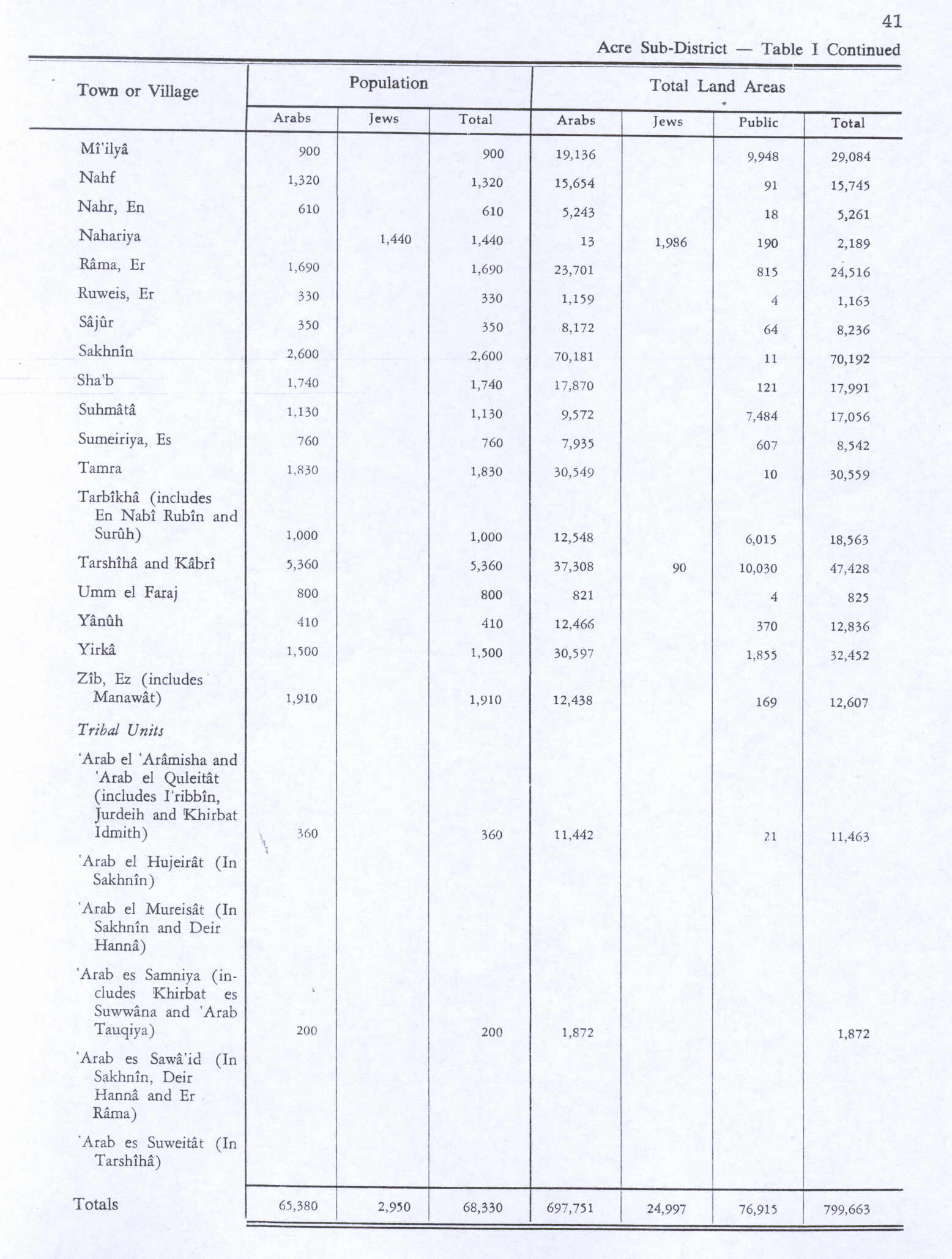
| • Total | 18,563 dunams (18,563 km2 or 7,167 sq mi) |
| Populasi (1945) | |
| • Total | 1,000[2][3] |
Tarbikha (Arab: تربيخا), adalah sebuah desa Arab Palestina. Desa tersebut berjarak 27 kilometer (17 mil) dari timur laut Akko di Distrik Akko, Mandat Britania yang direbut dan dikosongkan oleh Pasukan Pertahanan Israel pada Perang Arab-Israel 1948. Penduduk desa tersebut adalah Muslim Syiah, sama dengan penduduk Lebanon Selatan.
Referensi
- ^ Palmer, 1881, p. 56
- ^ Department of Statistics, 1945, p. 5
- ^ a b Government of Palestine, Department of Statistics. Village Statistics, April, 1945. Quoted in Hadawi, 1970, p. 41
- ^ Morris, 2004, p. xvii, village #66 Also gives cause of depopulation. Also see p. 474
- ^ Morris, 2004, p. xxii, settlement #154
- ^ a b c d Kesalahan pengutipan: Tanda
<ref>tidak sah; tidak ditemukan teks untuk ref bernama "Khalidi34"
Daftar pustaka
- Conder, C.R.; Kitchener, H.H. (1881). The Survey of Western Palestine: Memoirs of the Topography, Orography, Hydrography, and Archaeology. Vol. 1. London: Committee of the Palestine Exploration Fund.
- Department of Statistics (1945). Village Statistics, April, 1945. Government of Palestine.
- Frankel, Rafael (1988). "Topographical notes on the territory of Acre in the Crusader period". Israel Exploration Journal. 38 (4): 249–272. JSTOR 27926125.
- Hadawi, S. (1970). Village Statistics of 1945: A Classification of Land and Area ownership in Palestine. Palestine Liberation Organization Research Center.
- Hütteroth, W.-D.; Abdulfattah, K. (1977). Historical Geography of Palestine, Transjordan and Southern Syria in the Late 16th Century. Erlanger Geographische Arbeiten, Sonderband 5. Erlangen, Germany: Vorstand der Fränkischen Geographischen Gesellschaft. ISBN 978-3-920405-41-4.
- Khalidi, W. (1992). All That Remains: The Palestinian Villages Occupied and Depopulated by Israel in 1948. Washington D.C.: Institute for Palestine Studies. ISBN 978-0-88728-224-9.
- Mills, E., ed. (1932). Census of Palestine 1931. Population of Villages, Towns and Administrative Areas. Jerusalem: Government of Palestine.
- Morris, B. (2004). The Birth of the Palestinian Refugee Problem Revisited. Cambridge University Press. ISBN 978-0-521-00967-6.
- Palmer, E.H. (1881). The Survey of Western Palestine: Arabic and English Name Lists Collected During the Survey by Lieutenants Conder and Kitchener, R. E. Transliterated and Explained by E.H. Palmer. Committee of the Palestine Exploration Fund.
- Peteet, Julie (2011). Landscape of Hope and Despair: Palestinian Refugee Camps. University of Pennsylvania Press. ISBN 9780812200317.
- Rhode, H. (1979). Administration and Population of the Sancak of Safed in the Sixteenth Century. Columbia University. Diarsipkan dari asli tanggal 1 Maret 2020. Diakses tanggal 3 November 2017.
{{cite book}}: Pemeliharaan CS1: Tanggal diterjemahkan otomatis (link) - Röhricht, R. (1893). (RRH) Regesta regni Hierosolymitani (MXCVII-MCCXCI) (dalam bahasa Latin). Berlin: Libraria Academica Wageriana.
- Strehlke, E., ed. (1869). Tabulae Ordinis Theutonici ex tabularii regii Berolinensis codice potissimum. Berlin: Weidmanns.
- Totah, Khalil (1955). Dynamite in the Middle East. Philosophical Library. ISBN 9780802217318.
{{cite book}}: Ketidakcocokan ISBN / tanggal
Pranala luar
- Welcome to Tarbikha
- Tarbikha, Zochrot
- Survey of Western Palestine, Map 3: IAA, Wikimedia commons
- Tarbikha, at Khalil Sakakini Cultural Center
- Tarbikha photos, Dr. Moslih Kanaaneh

 | Artikel bertopik sejarah ini adalah sebuah rintisan. Anda dapat membantu Wikipedia dengan mengembangkannya. |
Konten ini disalin dari wikipedia, mohon digunakan dengan bijak.